Abraham ALLARD
1676 - 1725
Abraham Allard was born on January 8, 1676, in Amsterdam and died there on January 26, 1725. He was born into the Allard family dynasty of cartographers, engravers, and publishers, an active commercial print house operating in Amsterdam during the late 17th and early 18th centuries. The family enterprise was originally established by his grandfather, the engraver Huych "Hugo" Allard, and was subsequently managed by Abraham's father, Carel Allard. Raised directly within the family trade, Abraham received his practical training as a printmaker, painter, and map engraver under the guidance of his father, working alongside his brother, Hugo Allard the younger.
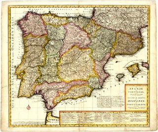
Allard worked primarily as a map engraver and publisher, contributing to the transitional period following the "Golden Age" of Dutch cartography. Rather than executing original scientific surveying, his cartographic approach relied on engraving artistry, utilising detailed etching and engraving techniques to produce decorative, stylised maps. On March 8, 1706, Abraham and his brother acquired the existing stock in trade and printing plates from their father, which allowed them to run the publishing business independently. Allard’s production strategy frequently involved updating and reissuing existing plates originally carved by older masters like Jan Jansson and Frederick de Wit. Key publications credited to Allard include his geographical distance table, Steden distancie meet tafel van Nederland, tot Paris toe (c. 1710), and his regional map, Ukraine fragment of Poland and Moscovia (1710). Following his career, several of his plates were acquired and reissued by the prominent Amsterdam publishing firm of Johannes Covens and Cornelis Mortier.
Abraham Allard is remembered as a skilled artisan of the Allard publishing lineage who maintained the decorative traditions of Dutch map engraving through plate compilation, modification, and printing.