
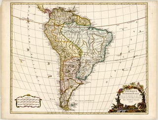
Gilles Robert DE VAUGONDY

1688 - 1766

Gilles Robert de Vaugondy was born in Paris, France, in 1688 and died there in 1766. He was born into a prominent French cartographic lineage, being a close relative of Pierre Moulard-Sanson, who was the grandson of Nicolas Sanson – widely regarded as the father of French cartography. From his family background, De Vaugondy inherited a substantial portion of the Sanson cartographic estate, including historical printing plates, maps, and geographical materials. He trained in Paris and subsequently passed this specialised geographic knowledge and business operation down to his son, Didier Robert de Vaugondy (1723-1786), with whom he collaborated closely throughout his career.

Operating during the 18th-century transition toward scientific cartography, De Vaugondy played a pivotal role in combining traditional decorative artistry with rigorous mathematical and astronomical accuracy. Holding the prestigious title of Géographe Ordinaire du Roi (Geographer to the King), he specialised in cross-referencing contemporary astronomical data, academic travel logs, and military surveys to verify geographic coordinates before engraving. His business expanded significantly through the acquisition of copper plates from other notable contemporary publishers, such as Hubert Jaillot. His milestone achievement is the Atlas Universel (published in 1757), a monumental collaborative work with his son that featured over 100 meticulously verified maps and set a new benchmark for corporate and national cartography in Europe. Beyond regional and global mapping, he and his son were highly regarded for their production of terrestrial and celestial globes, which were widely utilised for navigation and academic instruction.

Gilles Robert de Vaugondy is remembered as a central figure of 18th-century French cartography who successfully bridged the legacy of the Sanson dynasty with the strict empirical standards of Enlightenment-era map production.