Clément Adrien VINCENDON-DUMOULIN

1811 - 1858

Clément Adrien Vincendon-Dumoulin was born on March 4, 1811, in Chatte, France, and died on May 12, 1858, in Chevrières, France. He was the son of Claude Paul Vincendon-Dumoulin and Joséphine Pierrette de Beauvois de Nogaret. Vincendon-Dumoulin received a highly rigorous scientific education, entering the prestigious École Polytechnique in 1831 before choosing to join the corps of French naval hydrographic engineers in 1832. This extensive training equipped him with advanced mathematical and astronomical skills, which he applied directly to the surveying and mapping of coastlines during his early naval career at the Dépôt des cartes et plans de la Marine.

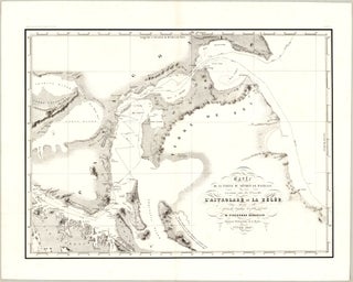
Vincendon-Dumoulin played a pivotal role in 19th-century hydrography through his meticulous contributions to maritime exploration and cartographic documentation. As the chief hydrographer on Jules Dumont d’Urville’s famous scientific expedition to the Antarctic and Oceania (1837-1840) aboard L’Astrolabe, he was responsible for executing precision topographical surveys from the ship’s deck under extreme environmental conditions. He achieved a historic cartographic milestone by drawing the very first map of Adélie Land (Terre Adélie) in Antarctica in 1840, alongside making the first calculations of magnetic inclination to help locate the magnetic South Pole. Following the death of Dumont d’Urville, Vincendon-Dumoulin was tasked with compiling and editing the monumental official records of the voyage, ensuring the scientific integrity of the charts and data published by the Dépôt de la Marine. His major publications include his extensive cartographic work within the multi-volume Voyage au Pôle Sud et dans l'Océanie, sur les corvettes l'Astrolabe et la Zélée (1843-1851), as well as historical and geographical monographs such as Îles Marquises, ou Nouka-Hiva (1843) and Îles Taïti (1844), both co-authored with César Desgraz.

Vincendon-Dumoulin will be remembered as a pioneering hydrographic engineer whose precise mathematical approach transformed polar exploration into rigorous scientific cartography.