
Franz HOGENBERG

Franz (also spelled Frans) Hogenberg was born in Mechelen, Flanders, in approximately 1535 or 1540, and died in Cologne, Germany, in 1590. He was part of a prominent family of artists and printmakers, as the son of the painter and engraver Nicolaas Hogenberg. Following his father’s death, Hogenberg was primarily trained by his stepfather, the mapmaker Hendrick Terbruggen, alongside his brother Remigius. Religious conflicts and the political upheavals of the Beeldenstorm eventually forced him to flee Antwerp in 1568 due to his Protestant ties. He spent time in London before permanently establishing a highly productive workshop and cartographic publishing house in Cologne around 1570.

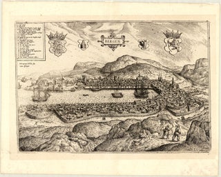
Hogenberg played a critical, pioneering role in early modern cartography as one of the period’s most prolific engravers and publishers. He was a central collaborator in the creation of Abraham Ortelius’ landmark Theatrum Orbis Terrarum (1570), recognised as the first modern world atlas, for which Hogenberg engraved many of the primary plates. Building on this systematic format, Hogenberg partnered with the Cologne theologian Georg Braun to publish the Civitates Orbis Terrarum (Atlas of Cities of the World), a milestone in publishing history. Published in six volumes between 1572 and 1618, it introduced a unique blend of geographical accuracy and high artistry and is universally recognised as the first systematic, comprehensive city atlas in cartographic history, specifically designed as an urban counterpart to Ortelius’ Theatrum Orbis Terrarum. Hogenberg engraved the copper plates for the first four volumes, integrating detailed bird’s-eye views and architectural layouts with foreground figures showcasing local costumes and customs. Braun acted as the principal editor, coordinator, and text author of the work. Following Hogenberg’s death in 1590, Braun continued the enterprise alongside Hogenberg’s son, Abraham, to whom the printing plates and stock were passed. Abraham maintained the workshop until his own death in 1653, after which the plates were acquired by the prominent Amsterdam publisher Johannes Janssonius.

Franz Hogenberg will be remembered as the definitive engraver of the Golden Age of Flemish cartography, who – together with Georg Braun – revolutionised the history of cartography by transforming 16th-century urban topographies into a vibrant, comprehensive, and definitive visual and textual record of world civilisation during the late Renaissance.