Daniel Friedrich SOTZMANN

1754 - 1840

Daniel Friedrich Sotzmann was born on April 13, 1754, in Spandau, Prussia, and died on August 3, 1840, in Berlin. He came from a family of craftsmen. His early education in engineering was unconventional, consisting of lessons from an imprisoned military officer at the Spandau Citadel, though he was largely self-taught as a surveyor. After moving to Berlin in 1774, Sotzmann secured a government position as a surveyor and draftsman, subsequently expanding his skills to include copperplate engraving.

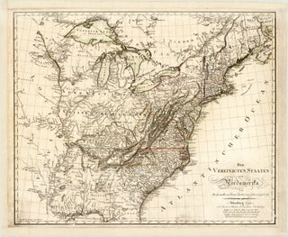
Sotzmann played a pivotal role in transitioning regional mapmaking into a commercial industry, and he is widely regarded as the primary initiator of commercial cartography in Berlin. In 1784, he was appointed Geographer of the Royal Prussian Academy of Sciences, a prestigious tenure that lasted nearly two decades. His work was characterised by a strong commitment to scientific accuracy, clear and unadorned engraving techniques, and utilising the most up-to-date regional sources. Sotzmann is highly celebrated for his collaboration with German historian Christoph Daniel Ebeling – he was commissioned to produce the highly detailed, multi-sheet atlas accompaniment to Ebeling’s monumental geography and history of North America. Alongside his regional surveys of Europe, his key publications include the meticulously drafted Die Vereinigten Staaten von Nordamerika (The United States of North America) and his early series of individual American state maps, as well as his production of accurate terrestrial globes.

Sotzmann will be remembered as a cornerstone of Prussian geography who elevated commercial mapmaking through his technical precision and his definitive cartographic recording of the newly emerging United States.