
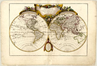
Jean/Robert JANVIER

Little is known about French cartographer Jean Janvier’s biographical dates, family background, and education. Also referred to as Jean Denis Janvier or Robert Janvier, he was professionally active in Paris between roughly 1746 and 1776. His works frequently bear the inscription “Le Sieur Janvier” or “Sr. Janvier”, and he held the prestigious title of Géographe Avec Privilège du Roi, indicating official recognition as a royal geographer during the French Enlightenment.

Janvier played a notable role in disseminating French cartographic knowledge throughout Europe during a period of intense colonial rivalry. His work is characterised by a combination of contemporary geographical discoveries, decorative aesthetic flourishes, and occasional speculative geography, such as the inclusion of the mythical “Sea of the West” in North America. He worked extensively with prominent publishers, engravers, and mapmakers of his era, including Rigobert Bonne, Giovanni Rizzi-Zannoni, Sébastien-G. Longchamps, and William Faden. His maps and copper plates were used as source material or as a printing base by other publishers, including for publications by Venetian publisher Paolo Santini and the Remondini family, as well as later editions by Charles-François Delamarche. Janvier is best known for his foundational cartographic contributions to the Atlas Moderne, ou Collection de Cartes sur Toutes les Parties du Globe Terrestre, first released in 1762 in collaboration with the Parisian engraver and publisher Jean Lattré, as well as his large-scale mural maps produced alongside Longchamps.

Janvier is remembered as a significant contributor to mid-18th-century French geography, whose collaborative atlas maps and royal backing helped define the visual and commercial standards of Enlightenment-era cartography.