
France
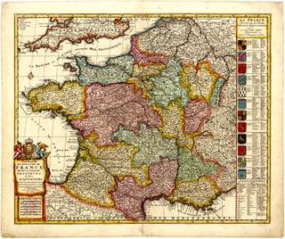
Item 120Carte Nouvelle du Royaume de France divise en toutes ses Provinces et ses Acquisitions.
Amsterdam: ELWE, Jan Barend, 1792 (dated)
58.7 x 48.3 cm / 23.1 x 19.0 in
Description This beautiful, contemporary-coloured map of France presents the country by provinces. It was published by Jan Barend Elwe in 1792 in Amsterdam. The map is richly detailed, with countless topographical features and placenames throughout.....