English Channel
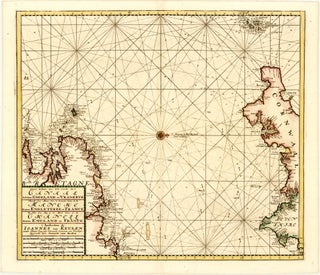
Item 114Nieuwe Zeekaart van t' derde Gedeelte van t' Canaal Tusschen Engeland en Vrankryk / Nouvelle Carte Marine Pour la Troisjeme Partie de la Manche Entre Engleterre et France / the New Sea Map of the Third Partie of the Chanell Betext England en France
Amsterdam: VAN KEULEN, Johannes, c. 1710
57.1 x 49.3 cm / 22.5 x 19.4 in
Description Oriented to the west, this sea chart by Gerard van Keulen focusses on the western end of the English Channel, taking in the adjacent coastlines of southwestern England and northwestern France. It reaches from.....