Australia • Indonesia • Papua New Guinea
The first English map to focus on Australia
London: BOWLES, Carington, 1717 [but 1781]
17.5 x 12.6 cm / 6.9 x 5.0 in
Description
This is the 1781 Carington Bowles edition of Herman Moll’s map of Australia, first published in 1717, in volume V of his Atlas geographus and later reissued in Bowles’s Atlas minor. It is the.....
Australia • Tasmania
A milestone French chart summarising Captain Cook's first historic mapping of eastern Australia
Paris: Hôtel de Thou, 1787-88
23.4 x 34.4 cm / 9.2 x 13.5 in
Description
This 1787-88 hydrographic sheet by Rigobert Bonne comprises one main chart and four detailed insets.
The main chart covers the entire east coast of Australia – then referred to as New South Wales or Nouvelle.....
Sydney, Australia
The first printed chart of Sydney Harbour
London: STOCKDALE, John, 1789 (dated)
40.9 x 26.9 cm / 16.1 x 10.6 in
Description
This is the first printed chart of Port Jackson, in New South Wales, Australia. It was prepared from the survey conducted by Captain John Hunter, shortly after the arrival of the First Fleet, in early.....
Australia • Oceania
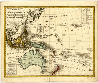
Scarce German 18th century map of Oceania, with Australia named "Ulimaroa"
Nuremberg: Homann Heirs, 1795 (dated)
57.2 x 45.0 cm / 22.5 x 17.7 in
Description
This map of the western Pacific Ocean extends from East / Southeast Asia and Australia to Hawaii (Sandwich Inseln) and the Marquesas Islands (Mendozas od. Marquesas Inseln), and from the Kuril Islands to New Zealand.....
Sydney, Australia
A wonderful view of Sydney from the beginning of the 19th century
London: JONES, Maurice, 1803 (dated)
14.7 x 8.2 cm / 5.8 x 3.2 in
Description
This view was engraved by Vincent Woodthorpe as an illustration for the The History of New South Wales by George Barrington, first published 1802-03.
The composition features the central section of Sydney Harbour, as seen.....
Sydney, Australia
An intriguing early view of Sydney
London: JONES, Maurice, 1803 (dated)
14.3 x 8.0 cm / 5.6 x 3.1 in
Description
This view was engraved by Vincent Woodthorpe as an illustration for the The History of New South Wales by George Barrington, first published 1802-03.
The composition features a supposed south view of Sydney. According to.....
Sydney, Australia
A rare and beautiful early French plan of Sydney
Paris: l'Imprimerie de Langlois, 1802 (dated) [but 1807]
21.4 x 14.9 cm / 8.4 x 5.9 in
Description
This remarkable plan of Sydney originated during the 1800-1804 French expedition to the southern seas commanded by Nicolas Baudin. Stricken with severe scurvy after charting the western and southern coasts of Australia.....
Tasmania
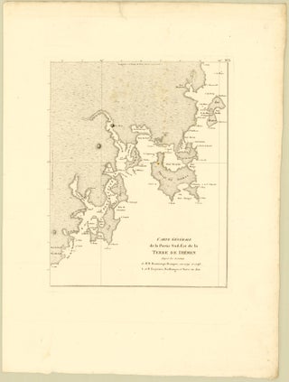
A rare masterpiece chart merging decades of French maritime exploration in Tasmania
BEAUTEMPS-BEAUPRÉ, Charles-François / BOULLANGER, Charles-Pierre / DE FREYCINET, Henri-Louis / DESAULSES DE FREYCINET, Louis Claude / FAURE, Pierre / PÉRON, François
Paris: l'Imprimerie Impériale, 1802 (dated) [but 1811]
16.7 x 21.1 cm / 6.6 x 8.3 in
Description
This scarce chart covers the intricate southeastern coastline of Tasmania (Terre de Diémen). It stretches from Cape Bailly in the north to South Cape in the south, and from Maria Island in the.....
Australia • Oceania • Western Pacific
Scarce Austrian 1815 map of Oceania, with curious use of the name “Australia”
Vienna: J. Riedl’s Kunsthandlung, 1815 (dated)
42.3 x 32.6 cm / 16.7 x 12.8 in
Description
This map of the western Pacific Ocean extends from East / Southeast Asia and Australia to Hawaii (Sandwichs Inseln) and the Marquesas Islands (Die Markesas oder Mendozas), and from the southern tip of Sakhalin.....
Sydney, Australia
A splendid early view of Sydney
Paris: BERTRAND, Arthus, 1824
21.3 x 14.9 cm / 8.4 x 5.9 in
Description
This fine view of Sydney originated during the 1800-1804 French expedition to the southern seas commanded by Nicolas Baudin. Stricken with severe scurvy after charting the western and southern coasts of Australia, Baudin’s crew sought refuge.....
Sydney, Australia
Very rare 1832 map of Sydney’s central waterfront
London: James and Luke G.[raves] Hansard & Sons, 1832 (dated)
36.1 x 30.6 cm / 14.2 x 12.0 in
Description
This is a coastal outline of the southern central section of Sydney Harbour and a cadastral map for a number of land grants in the present-day suburbs of Potts Point.....
Victoria, Australia
Scarce first standalone map of Victoria, made in Melbourne
Melbourne: HAM, Thomas, 1847 (dated)
73.9 x 47.4 cm / 29.1 x 18.7 in
Description
This foundational first-edition 1847 map by Thomas Ham encompasses the vast territory of the Port Phillip District during the decade preceding its formal separation from the colony of New South Wales. It was separately compiled.....
Sydney, Australia
A beautiful early view of Sydney
Sydney & Melbourne: Sands & Kenny, 1855
16.5 x 11.5 cm / 6.5 x 4.5 in
Description
This view originated as a drawing by the Anglo-Swiss artist and colonial engraver Frederick Casemero Terry. It was engraved in England and published in Sydney in 1855 by Sands and Kenny as part.....
Sydney, Australia
A beautiful early view of Sydney’s North Harbour
Sydney & Melbourne: Sands & Kenny, 1855
17.5 x 12.0 cm / 6.9 x 4.7 in
Description
This view originated as a drawing by the Anglo-Swiss artist and colonial engraver Frederick Casemero Terry. It was engraved in England and published in Sydney in 1855 by Sands and Kenny as part.....
Sydney, Australia
A beautiful early view of Parramatta
Sydney & Melbourne: Sands & Kenny, 1855
14.5 x 11.2 cm / 5.7 x 4.4 in
Description
This view originated as a drawing by the Anglo-Swiss artist and colonial engraver Frederick Casemero Terry. It was engraved in England and published in Sydney in 1855 by Sands and Kenny as part.....
Sydney, Australia
A splendid early view of Double Bay, Sydney
Sydney & Melbourne: Sands & Kenny, 1855
17.5 x 11.8 cm / 6.9 x 4.6 in
Description
This view originated as a drawing by the Anglo-Swiss artist and colonial engraver Frederick Casemero Terry. It was engraved in England and published in Sydney in 1855 by Sands and Kenny as part.....
Sydney, Australia
A fine early view of Farm Cove and Government House, Sydney
Sydney & Melbourne: Sands & Kenny, 1855
14.6 x 11.0 cm / 5.7 x 4.3 in
Description
This view originated as a drawing by the Anglo-Swiss artist and colonial engraver Frederick Casemero Terry. It was engraved in England and published in Sydney in 1855 by Sands and Kenny as part.....
Sydney, Australia
An engaging early look along Pitt Street, Sydney
Sydney & Melbourne: Sands & Kenny, 1855
14.6 x 10.8 cm / 5.7 x 4.3 in
Description
This view originated as a drawing by the Anglo-Swiss artist and colonial engraver Frederick Casemero Terry. It was engraved in England and published in Sydney in 1855 by Sands and Kenny as part.....
Sydney, Australia
A picturesque early glimpse of Sydney
Paris: Dufour, Mulat et Boulanger, 1861
15.0 x 9.9 cm / 5.9 x 3.9 in
Description
This view was drawn and engraved by Pierre Eugène Aubert during the first half of the 19th century. In the present example, it was issued posthumously in 1861 as an illustration for the Géographie universelle.....
Sydney, Australia
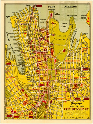
A very rare World War II-era plan of Sydney
Sydney: The Gregory Publishing Co., c. 1935-45
35.4 x 47.9 cm / 13.9 x 18.9 in
Description
This map by Clive Barrass shows the heart of the city of Sydney, from Dawes Point in the north to Chippendale and Prince Alfred Park in the south, and from Darling Harbour, Pyrmont.....